About CartoDruid - GIS offline tool
CartoDruid is a GIS application developed by the Instituto Tecnológico Agrario de Castilla y León (ITACyL), designed as a tool to support fieldwork. It addresses the challenge of offline editing of georeferenced...
CartoDruid is a GIS application developed by the Instituto Tecnológico Agrario de Castilla y León (ITACyL), designed as a tool to support fieldwork. It addresses the challenge of offline editing of georeferenced information.
In many field areas with insufficient mobile coverage, CartoDruid provides a reliable solution by enabling visualization of raster and vectorial layers stored on the device. It allows the creation of new geometries (entities) by drawing them directly on the screen or using embedded or external GPS.
CartoDruid is user-friendly and doesn’t require previous GIS knowledge, making it easy to configure and use for anyone managing fieldwork information. Data generated can be exported for use in external applications.
Features of CartoDruid include:
Visualization of online Google Maps.
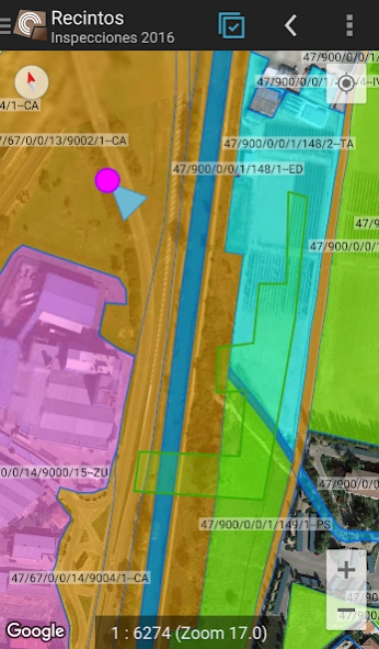
Usage of vectorial cartography in a SpatiaLite database.
Raster imagery support from a RasterLite database.
Online WMS services consumption.
Creation and configuration of new layers on the device.
Filtering, symbologies, labeling, searching, and identification forms based on SQL queries.
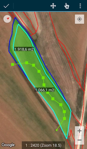
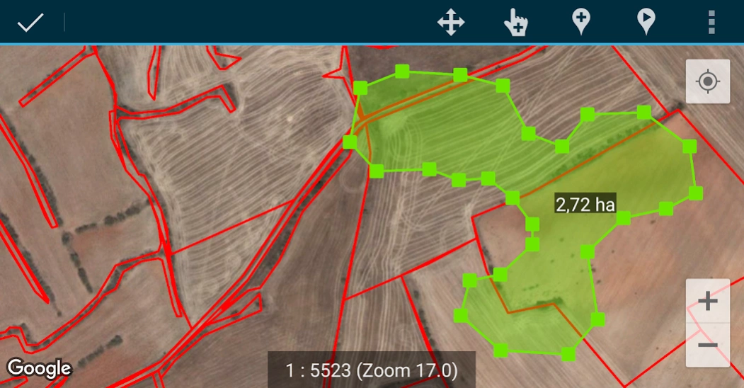
Editing attributes and manual drawing of geometries.
GPS-based drawing and editing of geometries.
Advanced geometry editing tools.
Data saving features, including georeferenced data and associating pictures to entities.
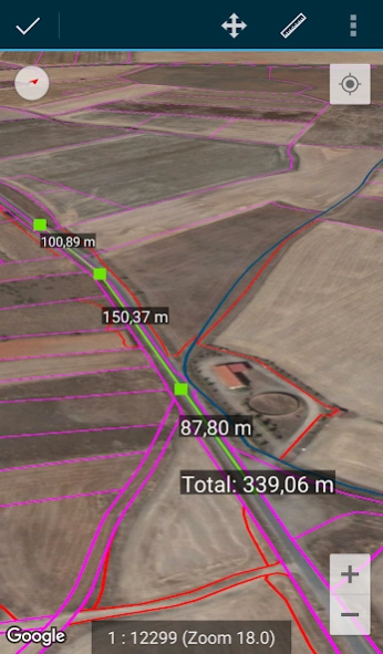
Additional tools like SIGPAC search, measurement tools, navigation aids, bookmarks management.
Import and export functionalities in multiple formats.
TOC management and SHP file support as an experimental feature.
Layer operation controls.
CartoDruid uses background location services for creating features based on location tracking. User location is only used for creating geometry vertices or map positioning, with data stored locally and not sent outside the device. Project folder deletion allows for easy data removal.
For a complete list of features, downloadable examples, and starting guides, visit www.cartodruid.es.
Previous Versions
Here you can find the changelog of CartoDruid - GIS offline tool since it was posted on our website on 2019-09-16 16:43:18.
The latest version is 0.62.4 and it was updated on 2024-04-22 12:02:35. See below the changes in each version.
CartoDruid - GIS offline tool version 0.62.4
Updated At: 2024-03-13
CartoDruid - GIS offline tool version 0.61.11
Updated At: 2023-11-12
Changes: Ability to change the Google user account associated with the application
CartoDruid - GIS offline tool version 0.61.10
Updated At: 2023-10-24
Changes: Ability to add a layer with a query as a data source
CartoDruid - GIS offline tool version 0.61.5
Updated At: 2023-06-08
Changes: - Improvements in the management of WMS and TMS services
- Configuration of Repository Folder to store reference cartography
CartoDruid - GIS offline tool version 0.61.1
Updated At: 2022-03-02
Changes: SIGPAC search bug fixed
CartoDruid - GIS offline tool version 0.61.0
Updated At: 2021-11-29
Changes: - Changes to adapt the application to the storage permission policy in Android 11
- Added security config and user management
- Various bug fixes
CartoDruid - GIS offline tool version 0.60.16
Updated At: 2021-08-11
Changes: Fixes for creating entities with UUID as primary key
CartoDruid - GIS offline tool version 0.60.14
Updated At: 2021-08-05
Changes: Correction in WMS's url
CartoDruid - GIS offline tool version 0.60.13
Updated At: 2021-08-03
Changes: Autosave user and location in layers with fields c_usuario, x_latitud, x_longitud
CartoDruid - GIS offline tool version 0.60.12
Updated At: 2021-06-17
Changes: Copy of entities within the same layer
Disclaimer
Official Google Play Link
We do not host CartoDruid - GIS offline tool on our servers. We did not scan it for viruses, adware, spyware or other type of malware. This app is hosted by Google and passed their terms and conditions to be listed there. We recommend caution when installing it.
The Google Play link for CartoDruid - GIS offline tool is provided to you by apps112.com without any warranties, representations or guarantees of any kind, so access it at your own risk.
If you have questions regarding this particular app contact the publisher directly. For questions about the functionalities of apps112.com contact us.